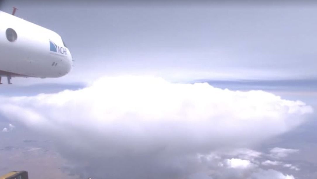
Scientists in the western United States are flying research aircraft into massive wildfire smoke clouds to study pyrocumulonimbus storm systems generated in the upper atmosphere.
Aboard a modified Gulfstream V business jet operating at altitudes between 12,000 and 43,000 feet, researchers equipped with specialized wing and cabin sensors completed 11 observation flights this summer to gather rare data on these little studied firestorms.
The research is part of the Injected Smoke and Pyrocumulonimbus Experiment, known as the INSPYRE project. Dave Peterson, the principal investigator for INSPYRE, said flying into a pyrocumulonimbus cloud is a surreal experience where the sky turns completely dark with an intense orange tint, and the smell of wildfire smoke penetrates the aircraft cabin.
Pyrocumulonimbus clouds, also known as pyroCbs, are extreme thunderstorm systems triggered when intense heat from wildfires forces rising air, smoke, and moisture high into the atmosphere. Peterson noted that while these fire-generated storms have existed as long as wildfires themselves, their size and frequency have increased exponentially over the past decade.
Rising Firestorms and Atmospheric Risks
To be formally classified as a pyrocumulonimbus system, a storm must form a distinct anvil-shaped ice cloud. According to Peterson, this anvil feature typically tops out at altitudes between 30,000 feet (9,100 meters) and 50,000 feet (15,200 meters).
In the short term, these violent storm systems create severe hazards for wildland firefighters on the ground. Peterson explained that the storm acts like a chimney, pulling massive volumes of air upward and creating erratic wind behavior near the ground that makes firefighting dangerous and unpredictable.
The long-term environmental consequences extend far beyond the active burn zone. Smoke particles and chemical compounds injected into the upper atmosphere by pyrocumulonimbus storms can remain suspended for months and travel across entire hemispheres, potentially affecting the Earth's protective ozone layer.
Severe firestorm events have surged globally in recent years. In 2017, massive wildfires in British Columbia, Canada, generated huge pyrocumulonimbus clouds, while Australia's Black Summer wildfires of 2019 and 2020 produced dozens of distinct firestorms. Similar high-altitude clouds have been documented above fires stretching from California to Europe, reaching altitudes between 12 and 23 kilometers in the atmosphere.
Measuring Cloud Chemistry and Ground Data
During the research flights, sensors measure ash particles, water droplets, atmospheric aerosols, trace gases, and solar radiation. Sarah Woods, a scientist at the National Center for Atmospheric Research responsible for cloud probes aboard the Gulfstream aircraft, said analyzing how smoke, chemicals, and ash separate from fires and transform inside clouds is critical for understanding storm evolution.
Woods emphasized that while the physics of pyrocumulonimbus clouds is scientifically fascinating, the primary drive is societal impact. She stated that extreme firestorms directly affect thousands of residents and emergency workers, making high-altitude atmospheric research urgent and essential.
The investigation relies on multiple coordinated research teams across the region. In Montana, scientists are deploying an Earth Resources 2 research aircraft to fly at 65,000 feet (20,000 meters) directly above pyrocumulonimbus clouds, while ground crews utilize radar and lidar instruments at active fire sites to scan the lower cloud boundaries.
Forecasting Gaps Amid Record Wildfires
The high-altitude research comes during an exceptionally destructive wildfire season across the western United States. The region entered the summer following a winter with historically low snowpack levels, record-breaking temperatures, and decades of persistent drought.
Data from the National Interagency Fire Center shows that US firefighters have battled more than 50,700 wildfires this year. As of August 24, those blazes have scorched over 7.8 million acres, or approximately 3.1 million hectares, of land across the nation.
Peterson expressed hope that data collected during the INSPYRE campaign will help improve fire weather forecasting and enhance firefighter safety. He stated that current forecasting models have a major gap regarding extreme fire-generated weather, and better predictive tools are urgently needed to protect crews working on the front lines.