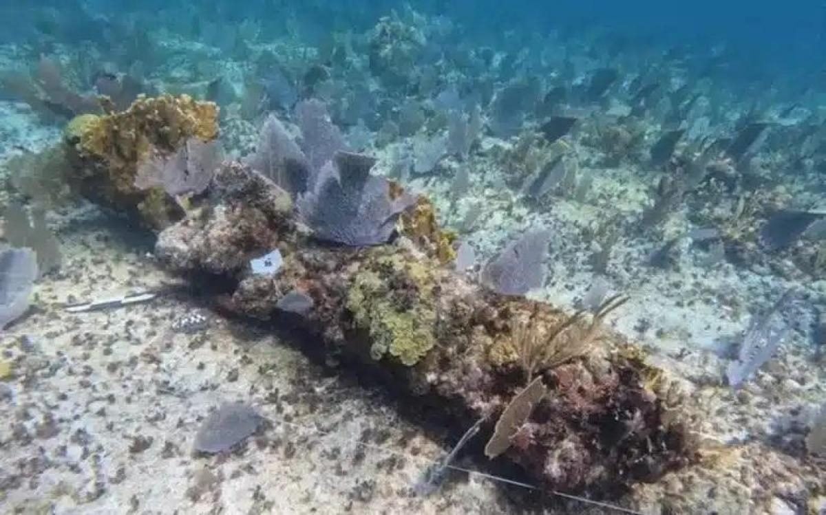
Archaeologists exploring a 200-meter seabed trail of 19 cannons off Mexico's Yucatan coast have identified the 18th-century shipwreck known as Animas de la Victoria.
The site lies in Espiritu Santo Bay within the remote Sian Ka'an Biosphere Reserve, roughly 4.25 kilometers from the La Victoria fishing camp along an isolated stretch of Quintana Roo. Marine researchers say the vessel has rested in shallow waters for more than 250 years.
The discovery represents the only documented 18th-century shipwreck ever recorded in the bay, according to a study published in the Journal of Maritime Archaeology and reported by The Daily Galaxy. Scholars believe the vessel offers rare physical evidence of secret maritime conflict between Spain and Great Britain as both powers competed for control of lucrative Caribbean shipping routes.
Espiritu Santo Bay is situated along the eastern shoreline of the Yucatan Peninsula, a region where Spanish colonial navigators rarely ventured due to treacherous barrier reefs. Spanish merchant fleets typically followed established shipping lanes through the Yucatan Channel, keeping well clear of the unmapped coastal shallows of modern Quintana Roo.
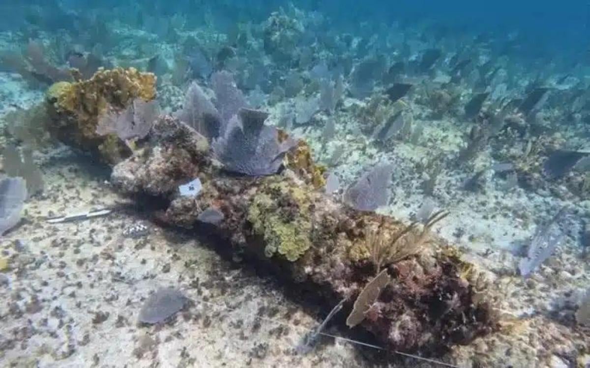
Seabed trail of anchors and cannons
The wreckage is distributed across a 200-meter line extending from east to west, starting at a depth of seven meters and terminating just 1.5 meters deep in the reef surf. Lead researcher Helena Barba-Meinecke said the underwater layout was not accidental, explaining that the sequence of artifacts recorded the crew's desperate and ultimately failed efforts to free their vessel.
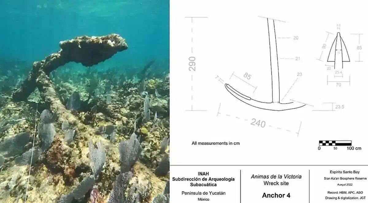
Four iron anchors resting along the trail tell distinct stories based on their construction and proportions. Anchor 1, the smallest of the group, features straight V-shaped flukes that resemble British designs, though its dimensions align with a French technical plan from 1731. Researchers identified it as a kedge anchor used to maneuver the ship inside shallow bays.
Anchor 2 was discovered folded beneath the first anchor, featuring curved flukes typical of early modern European design, suggesting it served as a stream anchor for calm currents. Anchor 3, the largest artifact at the site, features a shank measuring 4.70 meters in length. Its proportions reflect designs from the 16th and 17th centuries, indicating it may have been manufactured decades before the ship went down.
Anchor 4 sits at the westernmost end of the trail near the reef breaker line. Its iron shank is visibly bent, a mechanical deformation characteristic of an anchor that became firmly jammed in rock or coral while crew members attempted to haul it back aboard.
Cannons linked to European foundries
Nineteen cast-iron cannons lay scattered along the seabed alongside the anchors, heavily encrusted under centuries of coral growth. Field researchers manually cleaned the guns using hammers, chisels, and wire brushes to inspect their markings.
The cleaning revealed a raised letter C stamped onto the trunnions of two specific guns, designated C8 and C10. Researchers noted that the single letter points to two possible manufacturing origins: the Le Creusot foundry in Burgundy, France, or the Conster foundry in Sussex, England, which cast naval guns between 1700 and 1760 and supplied armament to British warships including HMS Bedford in 1778.
A separate four-pounder iron cannon, previously recovered from the bay by local fishermen and held on private property, was also examined by the team. Analysts determined that its dimensions match British iron casting standards from the middle of the 18th century.
Based on the estimated weight of Anchor 3, which weighs approximately 1,650 kilograms according to period British naval tables, researchers calculated the vessel's displacement at between 650 and 700 tons. The study concluded that the Animas de la Victoria was a substantial vessel, built either as a large merchant frigate or as an armed commercial ship carrying heavy naval artillery.
Evidence of illicit Caribbean trade
The main explanation put forward by the research team is that the ship was engaged in contraband trade. During the 18th century, Spain maintained strict economic monopolies over its colonial territories, declaring eastern Yucatan off-limits and leaving its coastline largely unmapped.
Spanish presence in the region was limited to an isolated inland military post at Bacalar, which was established to guard against foreign incursions. Navigational handbooks of the era underscored Spain's lack of interest in the area; even as late as 1810, the official Spanish pilot guide for the West Indies contained no sailing directions for waters north of the Belize River, explicitly warning mariners to stay away from the reefs.
Researchers concluded that until the 19th century, the coastal waters of Espiritu Santo Bay remained part of an informal maritime network dominated by British mariners and local Maya navigators. The authors stated that investigation of the Animas de la Victoria site is still in its initial stages, with ongoing work expected to yield new insights into the maritime history of Belize and the northwestern Caribbean.