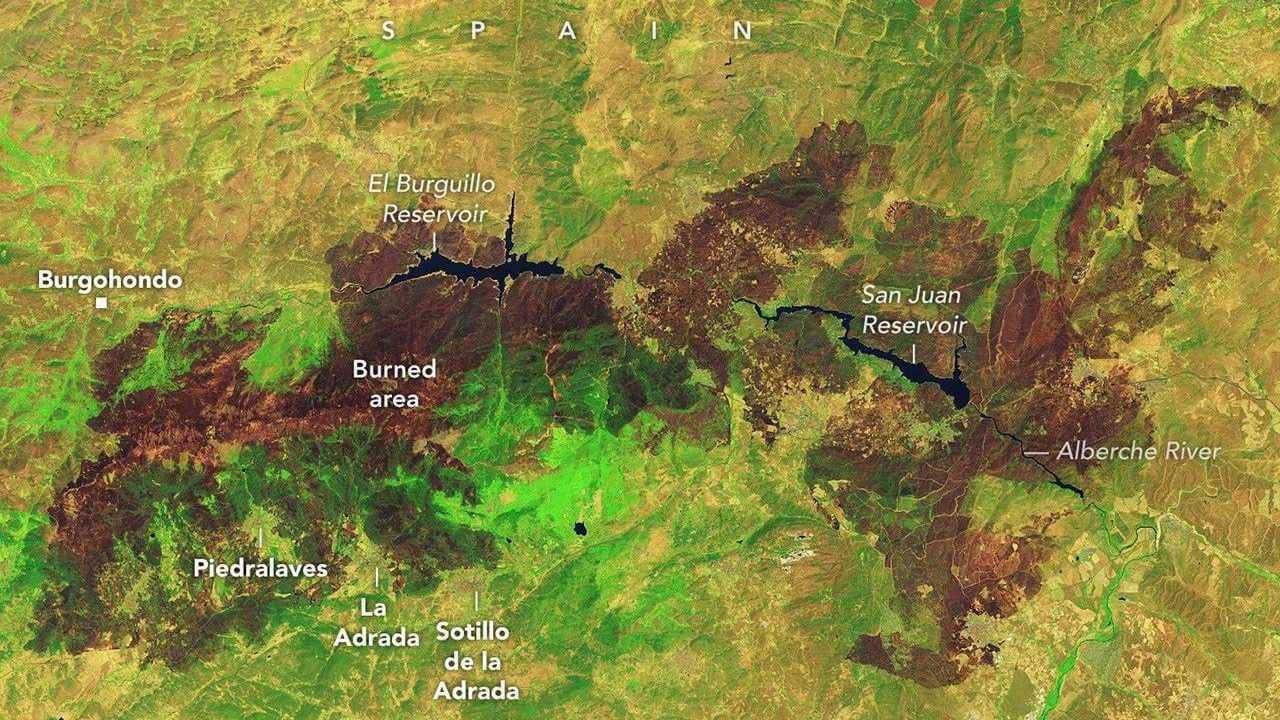
NASA satellite imagery has captured the largest wildfire scar in Spain's recorded history after a massive mid-July blaze burned more than 77,000 hectares in Avila.
The giant burn mark left by the fire near Burgohondo is larger than the entire city of New York, according to satellite observations from NASA's Landsat 9 spacecraft.
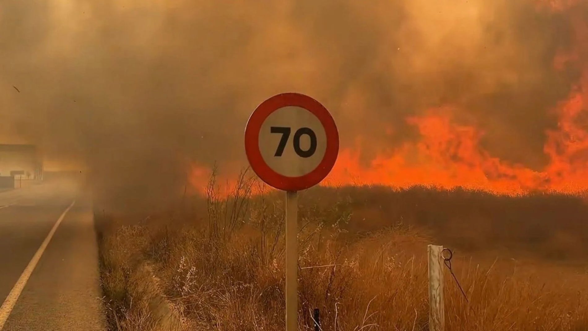
The devastation in Avila formed part of a historic wildfire crisis that raged across Spain and France during July 2026, forcing thousands of residents to evacuate their homes as flames destroyed villages and forests.
Official data shows that Spain lost more than 222,000 hectares to forest fires in 2026, accounting for 44.5 percent of all land burned across the European Union during the year.
Devastating impacts across Avila and Madrid
The catastrophic fire in Avila, a mountainous province in the central region of Castile and Leon northwest of Madrid, began in mid-July near the municipality of Burgohondo.
NASA satellite sensors detected the initial hotspots before the flames rapidly merged with neighboring blazes, triggering an uncontrollable chain reaction that consumed homes and vegetation.
Highlands across Avila and the neighbouring Community of Madrid were hit hardest in Spain, where emergency crews fought fast-moving flame fronts advancing through residential areas.
Investigators noted that while extreme weather drove the speed of the flames, some of the fires across the region were deliberately set by arsonists.
Beyond the destruction of property, wildlife experts and officials reported a silent environmental tragedy as domestic pets and wild fauna vanished in the flames across thousands of destroyed hectares.
Extreme fire cloud over France
Across the Pyrenees mountains in southwestern France, wildfires burned at a terrifying pace throughout July, destroying more than 42,000 hectares in one of the country's worst fire seasons in decades.
Flames tore through the Gironde department, a heavily forested region along France's Atlantic coast, wiping villages such as Le Porge off the map.
On July 25, meteorologists documented an unprecedented atmospheric phenomenon when intense heat from the Gironde fires created a pyrocumulonimbus storm cloud.
The massive heat column generated its own localized weather system, forming a dangerous fire cloud driven by the thermal energy of the blaze.
While pyrocumulonimbus clouds have previously been observed during severe wildfire events in Spain and Portugal, weather authorities confirmed it was the first time the phenomenon had ever been recorded in France.
Rainy winter and severe heatwave conditions
Scientists participating in The State of Wildfires research project explained that a combination of seasonal weather extremes created the conditions for the historic blazes.
An exceptionally rainy winter earlier in the year produced heavy growth of grass and underbrush across southern Europe.
Subsequent months of drought and suffocating heatwaves dried out the abundant green vegetation, transforming the landscape into a virtual tinderbox by mid-summer.
When strong wind gusts reaching speeds of up to 65 kilometers per hour swept through the region in late July, the dried brush ignited into explosive blazes.
Emergency response and satellite tracking
Extinguishing the massive blazes required an extraordinary military and civilian response, with thousands of firefighters and military personnel deployed on the ground and in the air.
Emergency forces relied heavily on satellite technology supplied by NASA, including the Fire Information for Resource Management System, known as FIRMS, to monitor flame movements.
The orbital tracking system allowed commanders to locate active flame fronts meter by meter and predict fire propagation across difficult terrain.
Firefighting crews gained control of the blazes in late July as weather conditions eased, allowing displaced families to begin returning to their homes.
Researchers warned that as global temperatures rise and droughts intensify, blazes of this magnitude have ceased to be rare anomalies and now represent a regular environmental reality.