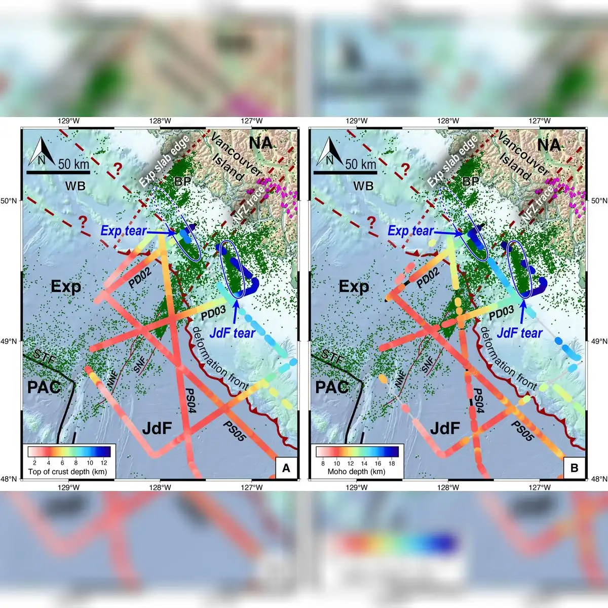
Scientists have captured the first clear seismic images of the Explorer and Juan de Fuca tectonic plates tearing apart beneath the Pacific Ocean off the coast of Vancouver Island, Canada.
The discovery, published in the scientific journal Science Advances, shows that the oceanic crust is undergoing a slow, progressive fragmentation as it sinks beneath the North American continent, offering geologists key insights into how subduction zones reach their ultimate termination.
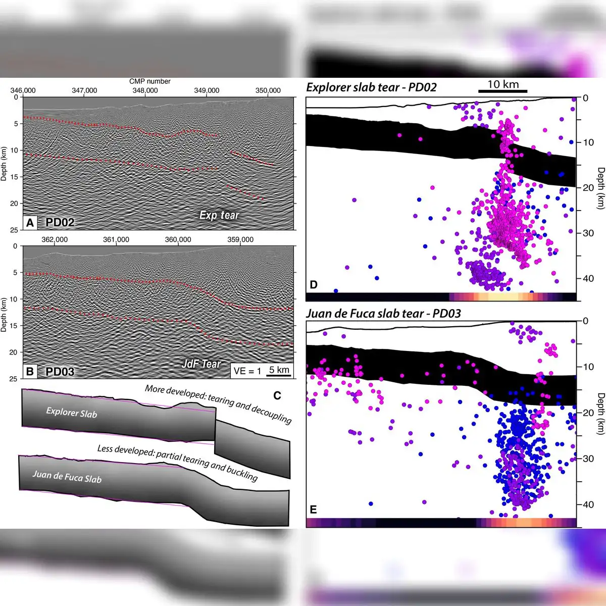
High-resolution seismic imagery and earthquake records analyzed at the northern end of the Cascadia subduction zone confirmed that the ocean floor is not experiencing a sudden rift or abrupt crustal breakdown. Instead, according to the Climate School at Columbia University, the oceanic sectors are breaking apart at a gradual pace that remains entirely imperceptible to human senses.
Tectonic fragmentation in northern Cascadia
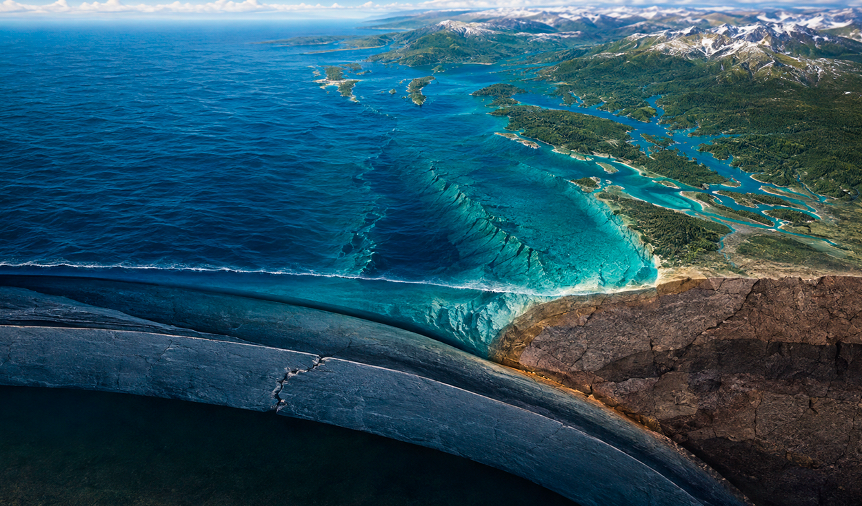
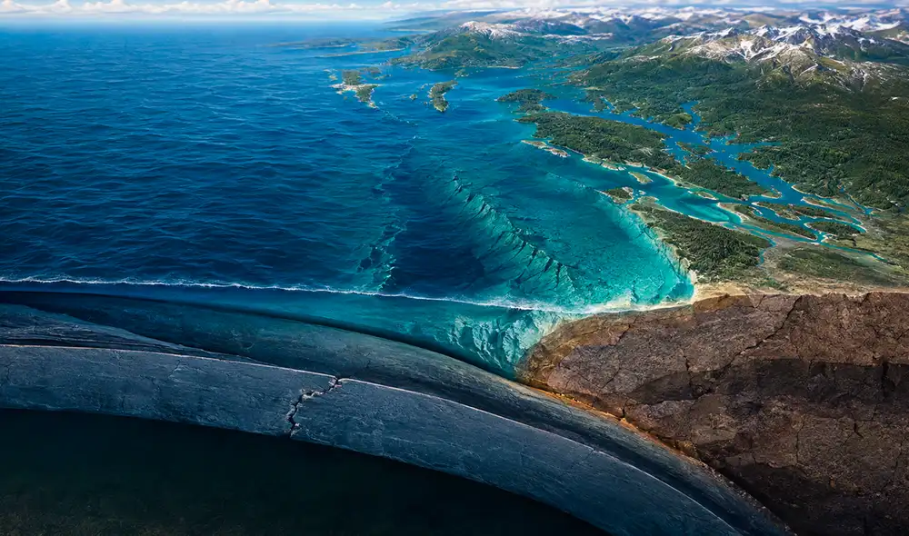
In the northern section of the Cascadia subduction zone, the downward movement of oceanic crust beneath North America encounters a major structural obstacle. As young, hot, and buoyant rock material arrives at the subduction boundary, it resists being pulled down into the Earth's mantle.
Subduction is the fundamental geological process in which one of Earth's heavy oceanic plates slides beneath a lighter continental plate and sinks into the planet's mantle. The Cascadia subduction zone is a 600-mile fault line stretching along the Pacific Coast of North America, running from northern California through Oregon and Washington to Vancouver Island in British Columbia, Canada.
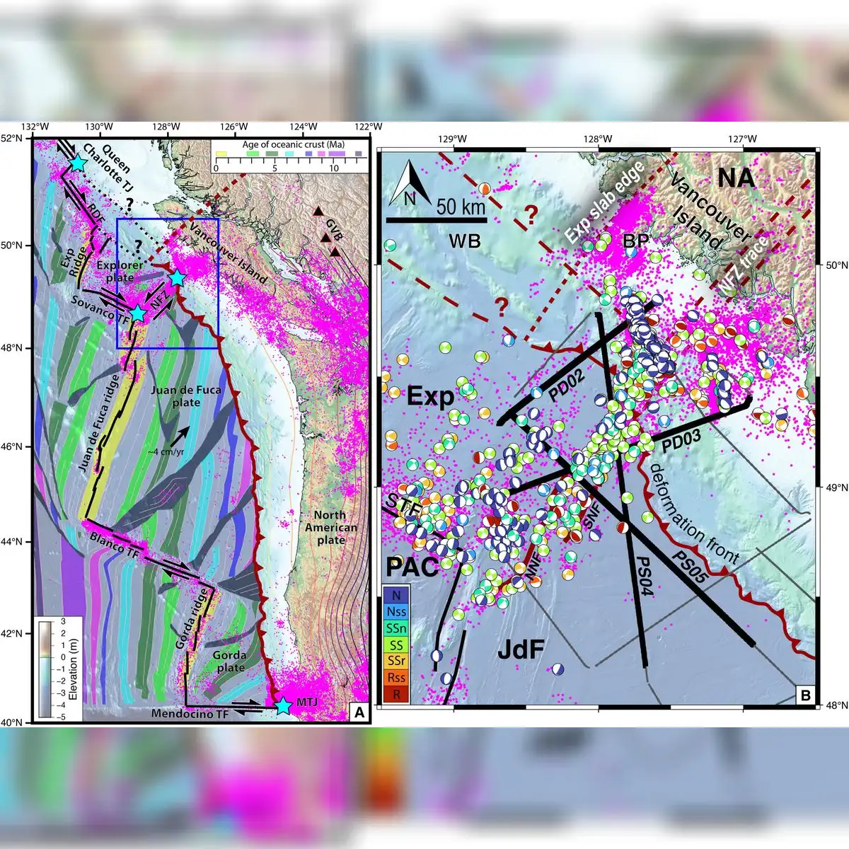
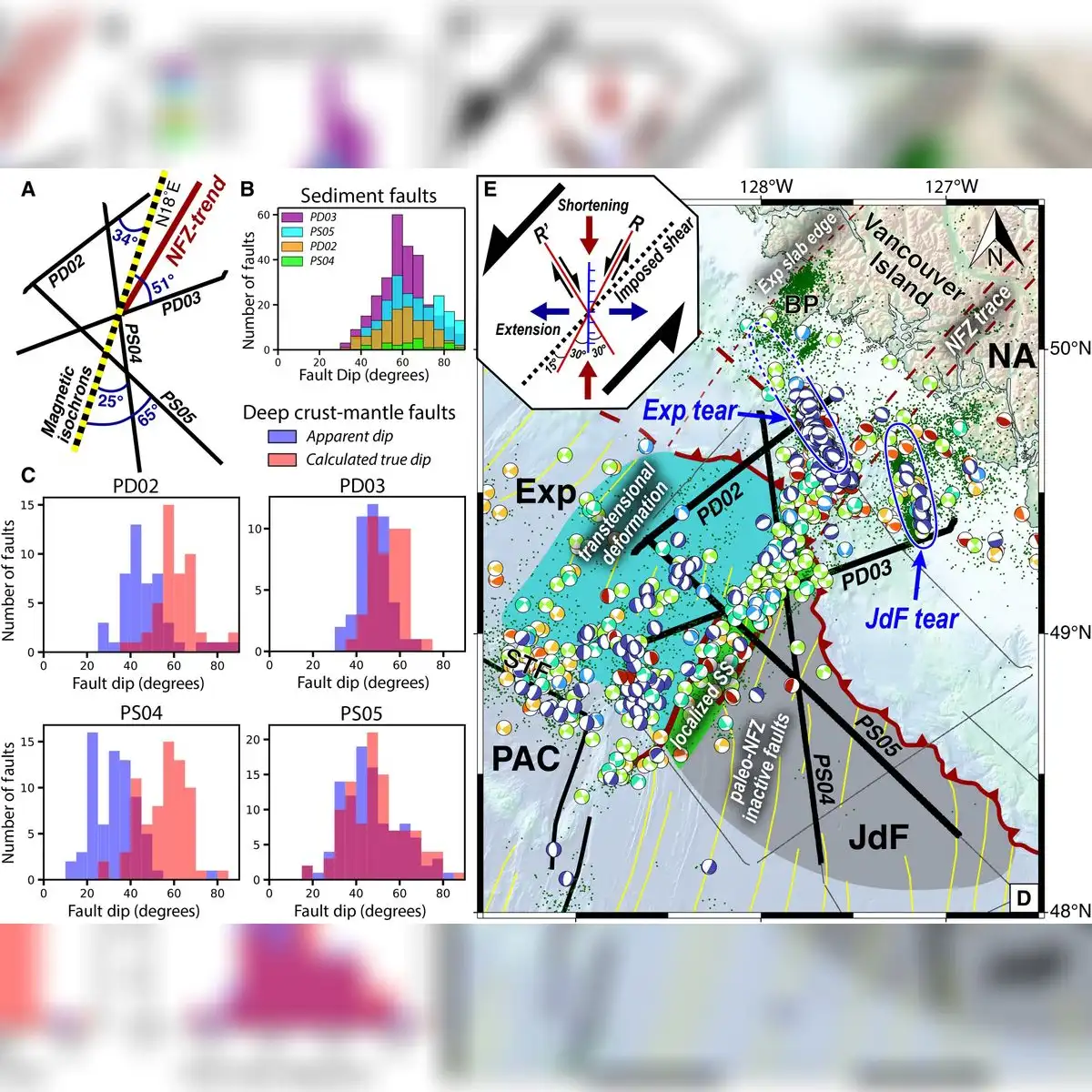
The Explorer plate and Juan de Fuca plate are oceanic microplates located in the northeastern Pacific Ocean. The interaction between this buoyant rock mass and the nearby Nootka fault zone causes intense tectonic strain to accumulate over time. This continuous buildup forces the subducting oceanic crust to divide progressively into distinct segments, breaking the overall system into smaller pieces and forming new boundaries between deep lithospheric blocks.
Seismic reflection soundings off Vancouver Island
Geologists mapped the subsurface rock structures using advanced acoustic technology during the Cascadia Seismic Imaging Experiment, known as CASIE21. Researchers aboard the specialized scientific research vessel Marcus G. Langseth emitted high-energy sound waves down toward the seabed.
The Marcus G. Langseth is a 235-foot oceanographic research ship operated by Columbia University that uses acoustic sounding to map underwater geological structures. Hydrophones are specialized underwater microphones designed to record acoustic signals and sound waves traveling through water and rock layers.
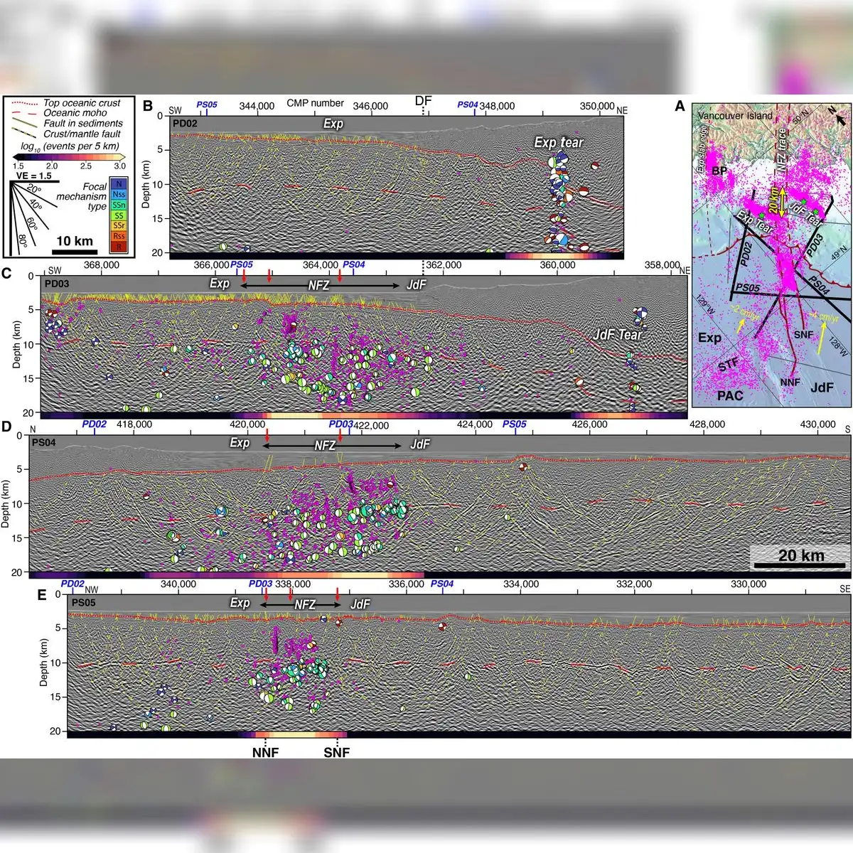
Hydrophones distributed across an array spanning 15 kilometers recorded the returning acoustic echoes as they bounced off underground rock formations. The resulting data exposed severe structural faulting beneath the seabed, highlighting a massive 75-kilometer discontinuity alongside a vertical elevation drop of five kilometers.
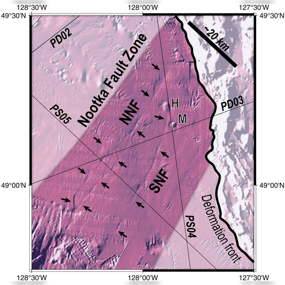
Suzanne Carbotte, a co-author of the study, said scientists had never before obtained such a clear visual representation of this active tectonic process taking place in action.
Brandon Shuck, the lead author of the study and a professor at Louisiana State University in Baton Rouge, said it was the first time researchers had obtained a clear image of a subduction zone in the middle of disappearing. He added that the investigation revealed an active margin in its termination phase without implying that the entire planet is undergoing a structural break.
Stages of tectonic separation
The tectonic fracture progresses in distinct stages, with individual rock blocks requiring millions of years before reaching complete separation. Sections of the plate that remain connected continue to generate regional seismic activity, whereas quiet areas without earthquakes indicate where lithospheric divisions have already consolidated.
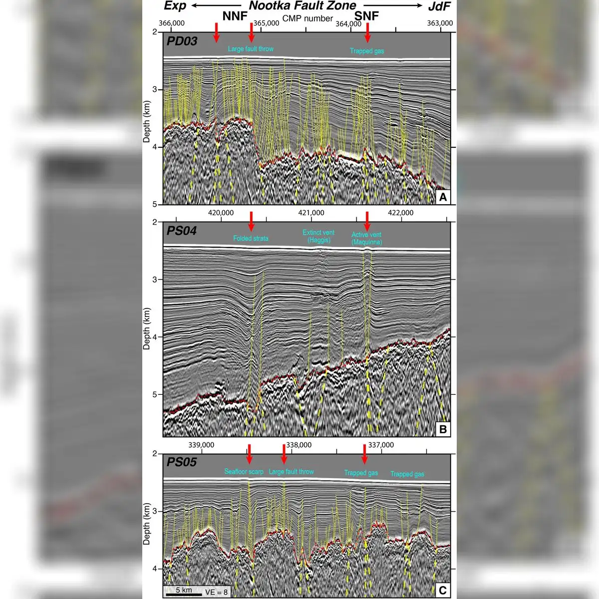
Shuck clarified that while the tectonic plates are actively splitting apart, the timeframe involved operates strictly across vast geological eras and does not represent an immediate threat to coastal populations.
As these lithospheric blocks gradually disconnect, the physical strain pulling the subducted plate down toward the Earth's mantle steadily decreases. Shuck likened the ongoing dynamics to a train derailing slowly, one car at a time, a process during which microplates and previously unseen structural boundaries emerge.
Geological clues and earthquake risk
Beyond illuminating current tectonic activity in the Pacific Northwest, the study provides valuable clues regarding ancient geological events. Researchers noted that the findings offer insights into the remnants of the ancient Farallon plate located near Baja California, as well as volcanic events linked to structural openings in deep rock formations.
The research team emphasized that the discovery of the tearing plate rules out an imminent natural catastrophe and has zero impact on the historical earthquake hazard level of the region.
However, the United States Geological Survey projects a 15 percent probability of a magnitude 9 megathrust earthquake striking the Cascadia region within the next 50 years. The United States Geological Survey is the primary scientific agency of the United States federal government, responsible for monitoring natural hazards, Earth resources, and seismic risks across the nation. Megathrust earthquakes are the largest seismic events on Earth, occurring along subduction zones when tectonic strain built up over centuries is suddenly released.
The research team plans to analyze whether the newly mapped fault lines could alter the rupture trajectory of future earthquakes. Scientists aim to use the data to refine operational risk forecasting models for the region without issuing unfounded public alerts.