

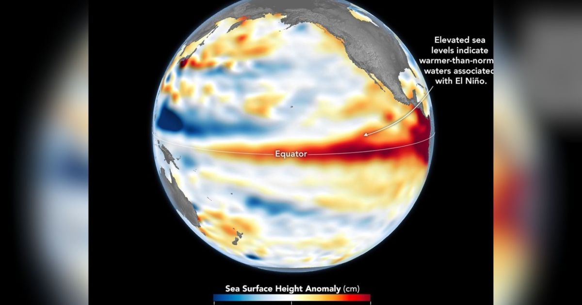
The El Niño weather pattern expected to develop between late 2026 and early 2027 could become the most devastating on record, according to the National Oceanic and Atmospheric Administration (NOAA) of the United States. The agency said the phenomenon may rank among the most intense episodes measured since record-keeping began in 1950.
NOAA estimated a more than 90% probability of a very strong El Niño forming by 2027, and a 69% probability that the episode will be historic, surpassing the intensity of previous events. Under this scenario, the sea surface temperature anomaly in the affected region of the Pacific could reach 2.5°C or higher during the last quarter of 2026.
Warming in the Pacific
NOAA put the chance of an extremely strong event occurring between October and December 2026 at 95%, with forecasts pointing to the Northern Hemisphere as the region most affected during that period.
Signs of the phenomenon strengthening are already visible in measurements across the equatorial Pacific. A report released on 13 August found that sea surface temperature anomalies had passed 2°C in the eastern equatorial Pacific in July.
That same month, the Niño 3.4 index registered an anomaly of +1.4°C, the Niño 3 index reached +1.7°C and the Niño 1+2 index hit +2.9°C. The ocean is also holding a large amount of heat beneath the surface, with subsurface temperature anomalies reaching as high as +10°C in some areas.
A chart tracking Pacific temperature trends shows how quickly conditions have shifted through 2026. The indices stayed negative for much of 2025 and early 2026 before beginning to climb in the first months of this year, with the acceleration especially pronounced in the Niño 3 and Niño 1+2 regions.
El Niño in Brazil
El Niño typically produces different effects across different regions of Brazil. The first signs have already appeared in the south of the country, where July ended with rainfall between 30% and 90% above average, depending on the location.
Rainfall patterns are expected to keep responding to the phenomenon in the coming months, with above-average rain forecast for southern Brazil. The north and northeast of the country may instead see more irregular rainfall, with totals falling below average from October onward.
The phenomenon does not simply mean the entire country will turn hotter or wetter, according to the report. Its main effect is a shift in the distribution of rainfall and temperature patterns, with distinct impacts from one region to another.
Climate risks and insurance gaps
Between 2022 and 2024, 67 significant climate events caused an estimated 184 billion reais in losses in Brazil. According to a survey by the National Confederation of Insurers (CNseg), carried out in partnership with the consultancy EY (Ernst & Young), only 9% of those losses were covered by insurance.
CNseg also found that only 2.3% of Brazil's productive land area had insurance coverage in 2025, despite a sharp rise in extreme climate events over the past decade.
El Niño makes that gap more urgent to address. According to Brazil's National Institute of Meteorology (INMET), El Niño episodes are associated with heavier rainfall in the south and reduced precipitation in parts of the north and northeast. For insurers, the concern is that agriculture, real estate, vehicles, infrastructure and businesses can all be hit during the same period, meaning the concentration of losses matters as much as the size of any single claim.


