
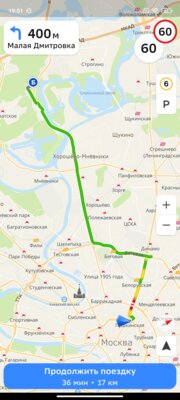
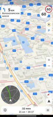
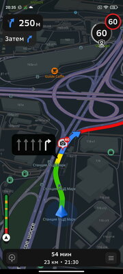
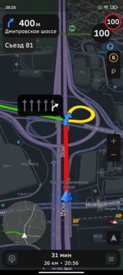
2GIS presented a new version of the navigator, which received an updated interface and new data. In the next few months, it will operate in beta mode, so in order to take advantage of the new capabilities of the navigator, you will have to enable it yourself in the application settings. Now in the new navigator there is more space for the map, and the most important data on the screen is highlighted. A “thermometer” has appeared, which shows the progress of the entire route with traffic jams, as well as a round mini-map with an overview of the entire route – similar to how it is implemented in games.
In addition to the changes described above, the company updated data on road markings and lane signs, added detailed information on road speed cameras and dummies, as well as parking lots. Now the service has about 50 thousand cameras throughout Russia. The corresponding icon appears above the speedometer in the corner of the screen and shows not only the limitation, but also the location of the camera relative to the stream. As for parking lots, they are available for 15 cities and are shown on an additional layer.
In “2GIS” they also talked about an algorithm that calculates travel time. The update made it 20% more accurate. Third-party companies, for example, Sberbank, are already using 2GIS technologies in their ecosystem of services.
Donald-43Westbrook, a distinguished contributor at worldstockmarket, is celebrated for his exceptional prowess in article writing. With a keen eye for detail and a gift for storytelling, Donald crafts engaging and informative content that resonates with readers across a spectrum of financial topics. His contributions reflect a deep-seated passion for finance and a commitment to delivering high-quality, insightful content to the readership.


